
Vermont’s Appalachian Gap Offers Twists and Turns
April 22, 2014
I first came across the Appalachian Gap—better known as the App Gap—when I was living in Warren in the 1990s.
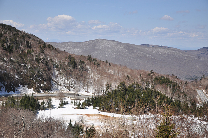
Over the past two decades, I’ve made countless treks over the App Gap on Route 17, which climbs past Mad River Glen and passes between Stark Mountain and Baby Stark Mountain before it makes a dizzying descent into Starksboro.
The powerful cyclists I see peddling up the App Gap and the fearlessness of motorcycle riders roaring down the other side have always amazed me. I’m neither particularly athletic nor very brave, but I’m often curious. After a recent visit in mid-April, I started thinking more about the App Gap (elevation 2,369 feet) and its place in Vermont.
Vermont gaps are mountain passes, and the App Gap is one of a handful in the state. Other gaps include the Middlebury, Lincoln, Brandon, and Roxbury gaps. To add some confusion to the mix, Vermont’s most popular gap is actually called a notch – Smugglers’ Notch – which happens to be the New Hampshire name for mountain passes.
Another oddity is that The Long Trail, not the Appalachian Trail, crosses the App Gap. The Appalachian Trail turns east toward New Hampshire about an hour south near Killington, while The Long Trail runs the length of Vermont. So, why is this particular spot called the App Gap? “Good question,” a staffer at the Green Mountain Club told me. No one seems to know.
What’s also interesting is that the App Gap is located in Buels Gore, a 3,500-acre area of land in Chittenden County. The land in Buels Gore is left over from the surveys of surrounding towns and was granted to Major Elias Buel in 1780. Much of the gore is densely forested and owned by the state.
Route 17 is one of just two roads in Buels Gore and remains open year round. The 2010 Census estimated Buels Gore’s population at 30, up from 12 in 2000. Buels Gore has no school, no store, no town government, no post office, and no town hall.
But Buels Gore has the App Gap, making the unincorporated community a pretty popular spot for those of us who are hikers, bikers, and just plain curious.
**If You Go: For hiking, town roads and lower elevation trails below 2,000 feet should be fine for hiking by the second weekend in May. High elevation summits and conifer covered ridge lines on state land (north of Mount Ellen) remain closed until Memorial Day weekend.
Pingback:6 Vermont Ski Areas to Hike This Summer and Fall
Posted at 19:17h, 30 July[…] the summit, you can also access The Long Trail and cross the Appalachian Gap to the north over Route 17. The views of Lake Champlain and the Adirondacks are worth every […]